Valle Camping is located in an area called “Vallebygden”. An area that streches along the north part of the table mountain “Billingen” 
The hills that form the landscape are mainly made up of gravel, sand and sediment from glacial rivers. This material accumulated in a glacial pit and then remained after the glacier melted. Another famous comb landscape is Skåne’s Brösarp hills.
NATURE RESERVE
The Valle area, thanks to its cultural landscape and distinctive nature with rich wildlife and plant life, is home to around eight nature reserves. Whether there are six or eight reserves depends somewhat on how one defines the borders of the Valle region, but regardless, there is a remarkable number of nature reserves within a relatively small area. The nature reserves Bockaskedeåsen-Toran, Eahagen-Öglunda meadows, Lake Hornborga, Höjentorp-Drottningkullen, Torp, and Ökull-Borregården are all located within Skara Municipality, while Lycke-Lilla Höjen and the Gullakrok Lakes are located within Skövde Municipality. There are excellent hiking trails through the nature reserves.
The hiking trails go through pastures, cultivated ditches and stone farms, groves with coniferous forests, calcareous marshes with orchids, flower meadows and lakes.
ANCIENT MONUMENTS AND FISHING
There are also ancient monuments in the area, such as rock chests, stone settlements and burial cairns. You can also fish in the many lakes if you get a fishing permit.
In early spring, thanks to the calcareous soil, there are plenty of bluebells to be found along the trails. These beautiful flowers are however protected but make excellent pictures!
CHERRY BLOSSOM
Another speciality of the area is when tens of thousands of cherry trees are in blossom along the Billings slope in spring. The most intense flowering lasts only a week or so, so it’s important to pick the right time to experience it.
Hiking in Valle: HIKING TRAILS
The area included in hiking in Valle is approximately 1,000 hectares in size and is said to have not less than 365 lakes (although this likely includes ponds as well), and thus up to 8 nature reserves.
The hiking trails in Valle have easy to medium difficulty and you can walk about 3 kilometres in an hour. Some routes may require boots or ankle boots depending on the season and weather.
One of the trails starts right at Valle Camping and you just have to put on your boots and get out of your cabin, tent, caravan, motorhome or hostel to start experiencing nature.

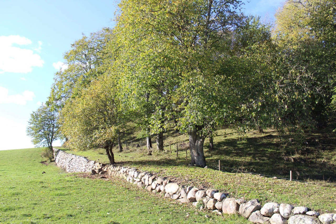
ÖKULL-BORREGÅRDEN
The nature reserve right next to the Valle campsite is called Ökull-Borregården and is the southernmost of the Vallebygden nature reserves. The nature reserve is about 72 hectares of which 61 are land and 11 are water.
The nature reserve contains so-called leaf groves, ridges with coniferous forests, marshes, small lakes and swamp forests with birch and alder. Plants you can find here include bride’s bread, maidenhair, ground thistle, red camomile, rosehips, hawthorn and red cornflower. There is also a marsh with several species of orchids.
The ridges largely follow the direction of movement of the ice. The most prominent of the ridges is “Getaryggen”, located east of Ökullasjön and extending about 5 km to the northeast. From here it is only a few kilometres to Varnhem and Varnhem Abbey Church with the ruins of the abbey and Kata Farm.
Dead ice pits that have become lakes
The terrain consists of a mixture of hills, small ridges, dead-ice pits (dead-ice pits) and hollows. The ridges and hills are made up of sandy gravel formed by the area’s bedrock, which consists of sandstone, alum shale, urbergine and, to some extent, limestone gravel. Many of the dead ice pits and hollows have gradually turned into lakes or marshes.
The lakes are connected to each other by a drainage system, which leads water from Grönsjön via Tjursbergsjön to Nycklasjön and Ökullasjön, and then on into Husgärdessjön (where Valle Camping is located). The limestone-rich soil has resulted in all lakes having a high pH value.
The large lakes in the reserve are Ökullasjön (16 ha) and Husgärdessjön (33 ha), both of which are less than 12 metres deep. The catchment areas of the lakes are very different in size (3 km² and 31 km² respectively). This implies a turnaround time of just under a year for Ökulla Lake and 1-2 months for Husgärdessjön.
Husgärdessjön receives water from the lake system north of the highway (Skärvalången and others), whose larger streams have their sources in the coniferous forest areas up on Billingen.
Settlement since before the Neolithic Age
The oldest known evidence of human presence in the area is a passage ditch, east of the nature reserve, dated to around 3400 BC. There are also two other Stone Age settlements in the vicinity of the nature reserve that are believed to be from the same time period. It is therefore very likely that there were settlements here before the Neolithic period.
In the Middle Ages, Ökull was a landed estate intended for the king’s maintenance and whose land belonged to the king, a so-called fiefdom. Ökull was both a royal farm and the central unit of Ökull’s (Kinda) bo (bo=the medieval name for the royal administrative districts).
In the 16th century, the manor was divided and gave rise to a village with the same name. In the 19th century, the village was merged into a manor, Ökull Manor. The lands belonging to Borregården (the monastery) probably belonged to Varnhem monastery before they became privately owned.
Hiking trail through Ökull-Borregården
The hiking trail through Ökull-Borregården is about 4 km long and you can reach it directly from the campsite. The trail is comfortable and partly tracked. There are several nice rest areas with benches along the trail.
It is also easy to reach with an extra walk several of the other hiking trails to hike in Valle from Valle camping, see the map below.
KARTA

On Skara municipality’s website you will find more information about Vander i Valle.
Respect the Right of Public Access
It cannot be repeated too many times, respect the right of public access! With the right of public access come responsibilities and obligations. For example, it is not allowed to break twigs, to make a fire in case of danger of forest fire or to walk on another person’s property. It is forbidden by law to walk in a field in a growing crop, to drive a motor vehicle off-road or to take birds’ nests or eggs.
Other rules also apply to nature reserves. For example, you are not allowed to pick flowers and you can only burn on built fireplaces. Signs show the special rules that apply in different reserves.
The following rules apply to Ökull-Borregården:
It is NOT permitted to:
- picking or digging up plants, fungi, mosses and lichens. However, it is allowed to pick berries and mushrooms
- Collect, destroy, or damage dead trees, large branches, and windfalls.
- Bring unleashed dogs.
- drive a motor vehicle. However, the owners of the summer cottages enclosed by the nature reserve have the right to drive motor vehicles on the gravel road that runs along the eastern side of Ökulla Lake in the nature reserve
- Park, camp, or set up caravans or motorhomes.
- Cycle, except on the gravel road along the east side of Lake Ökulla.
- Light fires.
- Organize military exercises.
- Put up signs, posters, or other disruptive items.
Without permission from the County Administrative Board, it is forbidden to:
- collect invertebrates. This does not apply to the collection of crayfish and tambin, the organisation of major sports competitions, camps, similar activities or large gatherings.
Read more about the Right of Public Access on the Swedish Environmental Protection Agency’s website and about the Ökull-Borregården nature reserve on the County Administrative Board’s website.
Valle Camping is located on private land outside the nature reserves, and our camping rules apply here.
Problems along the trail?
Please note that although one of the “Hiking in the Valley” trails starts from the campsite, it is not the campsite that maintains the trail. If you see something that does not work, or have suggestions for improvements and additions, please contact Skara Municipality, contact centre, telephone 0511-320 00 or report an error via the website skara.se/felanmalan.
Accommodation in the Valle area (Valleområdet)


trails
Flämsjön (ca 9 km)
The varied walk around Lake Flämsjön is just over 9 kilometers long. Park at Flämslätt, by the road west of Öglunda or north of Eggby, at Eahagen’s parking lot. The path goes through pastures with oak and broadleaf forest. At Acksjön, you pass Remningstorp’s arboretum, an exciting and well-signposted collection of trees from the entire northern hemisphere. Between Flämsjön and Ämten you walk on a narrow moraine ridge. East of Lake Flämsjön, the trail continues on winding paths and roads in the slightly hilly landscape.
Jättadalen (ca 5 km)
The path is quite steep up to the crest of Billingen. Once up on the diabase slope, you have a breathtaking view of Valle. Stop at the Offerkällan and drink cold and fresh water. There is a large parking lot just north of Öglunda church.
Torp (ca 3 km)
From the road between Varnhem and Öglunda, you walk up a gentle slope past Torps farm, where the path splits. You continue up through pastures and leafy groves, with ever wider views of the landscape below. Small parking space by the road.
Höjentorp (ca 3 km)
The hiking trail starts at the parking lot west of the castle ruins. You who are in a wheelchair can park at Höjentorp’s Kungsgård to reach the castle ruins by Trädgårdssjön via a wooden bridge The path continues on a partially paved path through broadleaf and mixed forests, where the many lakes are never far away.
Drottningkullen (2 – 3 km)
The paths at Drottningkullen are suitable for shorter excursions. The terrain is varied and hilly with a lot of slopes. Drottningkullen is extra powerful, from where you have views towards Varnhem. Parking space by the road.
Ökull (ca 4 km)
Here you can go directly from Valle Camping. From here, a partially paved path leads into the reserve. The hike offers birch and alder swamp forests, lakes, marshes, open pastures and leafy groves. If you want to sit down and rest for a while, enjoy the view or just take a break, you will find several rest areas with benches along the path. The trail is partly hilly.
Ljungstorp (ca 4 – 5 km)
Ljungstorp village center is a suitable starting point. From here, the path leads up Billingen to the ledge above Ljungstorp’s village. In clear weather you can see over Vallebygden, Hornborgasjön and all the way to Kinnekulle. On the way down from the diabase slope, the path passes a giant fir, the Ambjörntorpsgranen. You can follow the road through Ljungstorp back to the settlement or continue the hiking trail further to Torp.
From Skara municipality’s map